Save
You must be signed in to save park lists.
Your Park Lists
add New List
Add Photo
You must be signed in to add photos.
state route ranger badge
Illinois
52

Illinois State Parks

responsive menu icon
USA Parks
Illinois
Chicagoland Region
Kankakee River State Park
start slideshow
Kankakee River State Park Kankakee River State Park, IL © Allan Shorusaeli Issangya
A. Issangya
Kankakee River State Park Stream © Jeanine Reid
Kankakee River State Park Covered Bridge © Jeanine Reid
Kankakee River State Park View from Suspension Bridge © Jeanine Reid
Kankakee River State Park © Stephen Longmire
Kankakee River State Park From Suspension Bridge © Jeanine Reid
Kankakee River State Park River Observation Deck © Jeanine Reid
Kankakee River State Park © Stephen Longmire
Search
Availability
Calendars
Availability Search
KANKAKEE RIVER STATE PARK
5314 West Rt. 102
Bourbonnais, Illinois   60914

Phone: 815-933-1383
Reservations: 815-933-1383
Email: park email button icon
On land treasured for centuries - first by Native Americans, later by traders and farmers, and as early as the 1890's by recreation seekers - Kankakee River State Park offers you its proud heritage in an unspoiled setting. Anglers, canoeists, hunters, campers, hikers, bicyclers and other outdoor enthusiasts find the park's recreational opportunities unsurpassed. The naturally channeled Kankakee River, listed on the Federal Clean Streams Register, is the focus of the park's popularity.

Enveloping both sides of the Kankakee River for 11 miles, in an area 6 miles northwest of Kankakee, the park consists of approximately 4,000 acres. Illinois Routes 102 on the north and 113 on the south frame the park, with Interstates 55 and 57 both providing convenient access.
History of the Area
Several prehistoric sites are documented within Kankakee River State Park. The park is within a region used by Illini and Miami Indians at the time of the first European contact in the 1670s and 1680s. By 1685 the Miami were sufficiently numerous that the Kankakee River was called the River of the Miami. Kickapoo and Mascouten also were in the region from 1679 until the 1760s. Potawatomi Indians hunted along the Kankakee River in the 1760s, and by the 1770s, the Potawatomi, Ottawa and Chippewa nations - "The Three Fires" - dominated the area. The most extensive village was "Rock Village" or "Little Rock Village" inside the present-day park near the mouth of Rock Creek. In 1830 it was the site of the last great Indian Council. Following the Black Hawk War in 1832, the Potawatomi ceded all of their land along the Kankakee and Illinois rivers to the United States. Most Potawatomi left the area by the end of the decade, except for Chief Shaw-waw-nas-see, whose grave is commemorated by a boulder along the nature trail at Rock Creek.

Noel Le Vasseur and other fur traders, including Hubbard Chabare and Bourbonnais, traded with the Potawatomi along the Kankakee and Iroquois rivers in the 1820s. When the Potawatomi left the area in 1838, Le Vasseur persuaded a number of his fellow French Canadians to emigrate from Quebec to the Bourbonnais Township area. Because of his settlement efforts, he is called "the father of Kankakee."

A Marker on the west bank of Rock Creek Bridge commemorates the log cabin village of Rockville. It was begun in 1840, nine years after William Baker and other Euro-Americans first began farming along the Kankakee River.

The Kankakee & Iroquois Navigation Company - later known as the Kankakee Company - was chartered in 1847 to provide water power and a navigable waterway from the Illinois & Michigan Canal to Warner's Landing, along the site of the present-day Warner Bridge Road. The company failed in the early 1880s, shortly after the Wabash Railroad came through. At the Chippewa Campground, hand-cut limestone pillars mark where a railway bridge was to have been built before financiers ran out of money.

Just inside the park's main entrance is the Smith Cemetery with the graves of several family members, most of whom died of yellow fever at the turn of the century.

A major industry in the area in the 1890s was the Custer Bowery Amusement Park, which frequently drew crowds from Chicago. The park was gone by the 1920s, but by then the river had become a popular spot for summer cottages. The area became more accessible to vacationers in 1928 when concrete roads were built along both sides of the river. In 1938 Chicago resident Ethel Sturges Dummer donated 35 acres of land for a state park. Commonwealth Edison turned over another 1,715 acres to the state in 1956. With the company's additional grants in 1989, the park now roughly totals 4,000 acres.
FACILITIES AND ACTIVITIES OVERVIEW
Day-UseFishingyes
 Huntingyes
 Hiking Trailyes
 Swimming Beachyes
 Bike Trailsyes
 Bridle Trailsyes
BoatingLaunch Rampsyes
CampingPrimitiveyes
 Electric Sitesyes
WinterActivitiesyes
Park Store
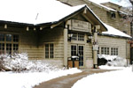
For refreshments, ice, camping supplies, firewood, and bait visit the log cabin concession stand, just inside the park's main entrance on the right.
Camping
Pleasant sites at reasonable prices make Kankakee River State Park a great place to pitch camp. Potawatomi Campground, a Class A area, has 110 sites and two Rent-a-Cabins in a wooded setting. More than 150 sites are offered at Chippewa Campground, which has Class B electric and C facilities. Reservations are taken for Kankakee River Class A, B, and C campgrounds. The Park closes at 10pm and all campgrounds observe quiet hours from 10pm - 7am. No vehicular traffic is allowed during this time. You must be 18 years old to rent a campsite and you must be able to establish your camp at the time you obtain a permit. All campsites share a picnic table and a campgrill. Camping is only allowed in the campgrounds.

Davis Creek Campground is available by reservation for chaperoned youth and church groups. All areas require camping permits, available at the park office or from park personnel in state vehicles. *All correspondence should be mailed to P.O.Box 37, Bourbonnais, IL 60914
Canoeing
The river's shallow water and rocks are no problem for canoeists. Bring your canoe and enjoy the beautiful scenery.


Picnicking
For a light lunch or a large get-together, check out the park's picnic areas. Shelters and tables are placed in pleasant settings throughout the park, and you'll also find playgrounds in several locations. Shelters are available on a first-come first-served basis. All shelters have campgrills. Three shelters may be reserved by calling the park office for reservation forms. Groups of 25 or more are asked to obtain a permit, which is free, at least two weeks before planning to visit the park.
Trails
The park's trail system stretches for miles along both sides of the river. Hiking, biking and cross-country ski trails are on the river's north side, while horse and snowmobile trails can be found on the south. A 3-mile route along Rock Creek lets hikers take in the beauty of limestone canyons and a frothy waterfall. A bicycle trail begins at Davis Creek Area and travels 10.5 miles of trails in the form of a linear trail along the river and a loop in the west end of the park.

A 12-mile equestrian trail is located in the wildlife management area along Route 113 and is open April 1 through October 31. When there's snow cover of 4 inchesor more, the park is open from sunrise to sunset for snowmobiling. Directional signs for trails are posted and maps are available at the park office.
Nature Programs
Set out on a guided hike with the park interpreter and learn about the history, geology, and wildlife of Rock Creek Canyon and the park. Senior citizen walks and childrens' programs are available and all programs are free. Call the park office for a schedule of programs and events. Schools, scout groups, or other large organizations should call for reservations.

Visitor Comments, Memories and Reviews
March 23 hiking/fishing/. at its best by gonefishingk3
park review stars; one to five cant believe this is only an hour from chicago area.doesnt feel like illinois awesome!!!!
September 14 A great family park. by William Near Chicago
park review stars; one to five This state park has it all. Camping, hunting, walking trails. This is what a state park should be. Well maintained and user friendly.
January 29 Nice for biking by Amma
park review stars; one to five A nice 10 mile biking trail runs parallel to the river for a gorgeous ride. Long stretches are level and suitable for beginners. Beautiful trees, lots of shade, pretty bluffs along the river. Many nice, clean picnic areas and playgrounds, cute little nature center. A low-key and generally uncrowded place that offers a lot to the laid-back nature lover. Equestrian, cross-country ski, and snowmobiling trails available. The river is easily boatable, but NOT swimmable due to dangerous and unpredictable currents and drop offs. Campgrounds are pretty, clean, wooded, and well-maintained.
write a review read more reviews
Share On

Area Campgrounds
Fossil Rock Recreation Area
24615 West Strip Mine Road
Wilmington, IL
815-476-6784
Area Accommodations (over 20 miles away)
businesss listing main photo
Hotels/Motels
Relax in the rustic beauty and comfort of Starved Rock Lodge, Cabins and Starved Rock Inn. The historic Lodge has 69 guest rooms, which include three bay-window rooms, plus cabins nestled in the woods. Fireplaces can be found in four of the eight sunset cabins near the pool area...
50.5 miles from park*
businesss listing main photo
Cottages and Cabins
Within a 10 minute drive from Starved Rock and even closer to Matthiessen State Parks you will find a gorgeous, tranquil property with spacious cabins on 50 wooded acres. All with full kitchens and outdoor fire pits. 3 dog friendly.
53 miles from park*
Nearby Hotels
Booking.com

Directions
From North or South on Interstate 57, Take I 57 to Exit 315 (Bradley-Bourbonnais) Take Rte. 50 south to the first stop light which is Armour Rd. Turn right on Armour Rd. and go to the 3rd stop light which is Rte. 102. Turn right (west) on Rte.102. The park is located 7 miles west on Rte. 102.

From the North on Interstate 55, Take I 55 to exit 238 (Braidwood). Take Rte. 129 south until coming to Strip Mine Rd. Turn left (east) on Strip Mine Rd. Follow this road until coming to a small town called Wilmington. In Wilmington, turn right on Water Street. Water Street becomes Rte 102. The park is located 10 miles east of Wilmington on Rte. 102.

From the South on Interstate 55, Take I-55 north to Dwight Exit (Rte.17). Take Rte. 17 east. Go approximately 20 miles to Warner Bridge Rd. Turn left (north) on Warner Bridge Rd. Follow this road approximately 10 miles until coming to Rte. 102. Turn right (east) on Rte. 102. The park office is located 1 1/2 miles east of Warner Bridge Rd.

state route ranger badge
Illinois
52

Illinois State Parks

X