HENNEPIN CANAL PARKWAY STATE PARK
Want a peaceful, relaxing day of picnicking, hiking, fishing and good old fashioned family fun? Hennepin Canal Parkway State Park is just the place you're looking for. Spend the day and bring a picnic lunch along. There are plenty of picnic tables at the 104.5-mile linear park which spans five counties (Rock Island, Bureau, Henry, Lee and Whiteside).
The Hennepin Canal is more than just a fun place. It played a very important role in the history of the United States and to commerce and industry. In fact, the entire canal is listed on the National Register of Historic Places.
Thoughts of constructing a canal that connected the Illinois and Mississippi River date back to 1834. But financial problems in the state held back many public works projects. Pressure for a transportation shortcut that was cheaper than rail continued though, and Congress authorized preliminary surveys on the project in 1871. Construction finally got under way in 1892 and the first boat went through in 1907, reducing the distance from Chicago to Rock Island by 419 miles. There was a problem, however. As this canal was under construction, the Corps of Engineers was widening the locks on both the Illinois and Mississippi Rivers. With lock chambers twenty and forty feet narrower than the rivers it connected, the canal was obsolete before the Marion made her initial voyage.
By the 1930s it was used primarily for recreational traffic. The Hennepin and its sister canal, the I & M, tied the Illinois, Des Plaines and Mississippi river systems into a transportation network connecting Lake Michigan to the Gulf of Mexico. The I & M was completed nearly 60 years earlier and helped make Chicago one of the nation's greatest cities. The Hennepin Canal, which at one time was known as the Illinois and Mississippi Canal, was open to boat traffic until 1951. There was no cost to use the canal. Ice made from the canal's frozen waters was sold during the winters to help pay the canal's maintenance costs.
The Hennepin was the first American canal built of concrete without stone cut facings. Although the Hennepin enjoyed limited success as a waterway, engineering innovations used in its construction were a bonus to the construction industry. Some of the innovations pioneered on the Hennepin Canal were probably used on the Panama Canal. Both used concrete lock chambers and both used a Feeder canal from a man made lake to water the canals because both needed water to flow ?uphill.?
There are 33 locks on the canal. Thirty-two are still visible. The first one, on the Illinois River, has been under water since the 1930's. Fourteen of the locks had Marshall gates, which are unique to the Hennepin, and are raised and lowered on a horizontal axis, much like a rural mailbox. Five of the locks have been restored to working condition, although they are not used. One of these is a Marshall Gate lock. All of the gates from the remaining locks have been replaced with concrete walls, creating a series of waterfalls.
The Hennepin originally had nine aqueducts -- concrete troughs which carried the canal and its traffic across larger rivers and streams. Today, six remain the other three are replaced by pipes that carry the canal flow under the creek or river the aqueduct crossed over.
Class "C" and Youth Group camping are allowed along the Hennepin Canal Parkway at the following locations:
Lock 11, West of the Canal Prism
Lock 17, Northwest of the lock
Lock 21, North Day Use Area (drinking water available)
Bridge 14, North bank.
Lock 22, Southwest of the lift bridge (drinking water available)
Bridge 23, South bank
Lock 23, just West of the parking lot.
Lock 26, South bank
Equestrian camping is restricted to the south side of the Lock 21 area. Please clean up after your horses.
There's unlimited horsepower for boats (between bridge 37 and Lock 24) at the Hennepin; elsewhere it's 10 horsepower. Take off on the launching ramp at the Visitor Center complex, Locks 21, 22 & 24, Route 82 north of Geneseo, Route 92, Route 78 north of Annawan, bridge 39, bridge 28 and bridge 45.
Anglers can enjoy fishing in the 104.5-mile canal, which is home to various species including crappie and bluegill. The park also offers opportunities for catching largemouth bass, channel catfish, bullhead and carp. A valid Illinois fishing license is required for all anglers aged 16 or older.
If canoeing is your sport, come ready for a workout! The waters are calm so back and arm power are required. The many locks are no longer operational and must be portaged (from Lock 21 east is particularly tough). For a great 1-2 day trip, begin at Rock Falls and continue to the Visitor Center.
Hennepin Canal Parkway State Park is located near Kewanee, Princeton
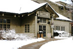
Picnic tables are sprinkled throughout the day use areas and main complex for your relaxation and enjoyment. Three shelters in the park's main complex near Sheffield provide areas for group gatherings-- the largest one can be reserved -- so call ahead. Playground equipment, located at the largest shelter, will keep the kids busy while the grownups have a chance to chat. Drinking water is available at Locks 21 and 22 from hand pumps, as well as the Visitor Center. Outdoor toilets are located at Locks 3, 6, 11, 17, 21, 22, 23, 24, and 26; Bridges 14, 15, and 23, as well as the Visitor Center on the Main Canal. There are facilities at Bridges 50, 52 and 64 on the Feeder Canal.
Hiking:
An old tow path, originally intended but never used by animals for towing boats along the canal's main line and feeder routs, provides 155 miles of one-foot-after-the-other fun. Because you're right next to the canal, you'll get a great view of its locks and aqueducts, not to mention the animal life. The going is level and easy at the Hennepin -- but be sure to make several stops along the way if you're hiking the canal's entire length.
If you're up to something more challenging, try the 4.5-mile trek in the main complex which is moderately difficult and gives you a broad taste of landscape from tall timber to grasslands to marsh.
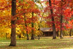
Hiking here is particularly satisfying in the fall, when Mother Nature works her wonders on the leaves.
Bicycling:
With the completion of the new trail surface, mountain bikes are no longer a necessity. East to west the trail is surfaced from Bureau Junction, near the Illinois River, to Colona on the Rock River. There is a Feeder Canal to Rock Falls, 29.2 miles long, completed. Bring your own refreshments as only three areas along the corridor have water (Locks 21, 22 and the Visitor Center). Be sure to yield the right of way to horses.
The park offers a variety of birding options with over 100 species spotted, including waterfowl and songbirds. Birdwatchers can enjoy the five-mile stretch along the feeder canal for optimal viewing opportunities. The area is also part of the Mississippi Flyway migration route which attracts many birds during spring and fall seasons.

Cottages and Cabins
Within a 10 minute drive from Starved Rock and even closer to Matthiessen State Parks you will find a gorgeous, tranquil property with spacious cabins on 50 wooded acres. All with full kitchens and outdoor fire pits. 3 dog friendly.
35.3 miles from park*

Hotels/Motels
You will feel right at home when you reach Carroll County, our corner of beautiful Northwest Illinois. The magnificent Mississippi River and outdoor spaces will refresh your spirit and touch our soul.
57.9 miles from park*

Hotels/Motels
Relax in the rustic beauty and comfort of Starved Rock Lodge, Cabins and Starved Rock Inn. The historic Lodge has 69 guest rooms, which include three bay-window rooms, plus cabins nestled in the woods. Fireplaces can be found in four of the eight sunset cabins near the pool area...
36.5 miles from park*
The Hennepin Canal Parkway basically parallels I-80 in Bureau and Henry counties in west central Illinois. The Parkway's Visitor Center is one mile south of I-80, just west of Route 40. East or westbound travelers on I-80 should take Exit 45, turn right (south) on Route 40. They almost immediately cross the Canal and in about 1 mile is the brown sign directing them to the Parkway Visitors Center. Turn right (west) and proceed to the Center.


